Optimize credit issuance with precision
Solve VM0047, VM0048, and related methodology requirements, or generate portfolio-wide geospatial analytics faster and at lower cost with clear data management, traceable outputs, and audit-ready records
Methodology-aligned, geospatially derived project assets
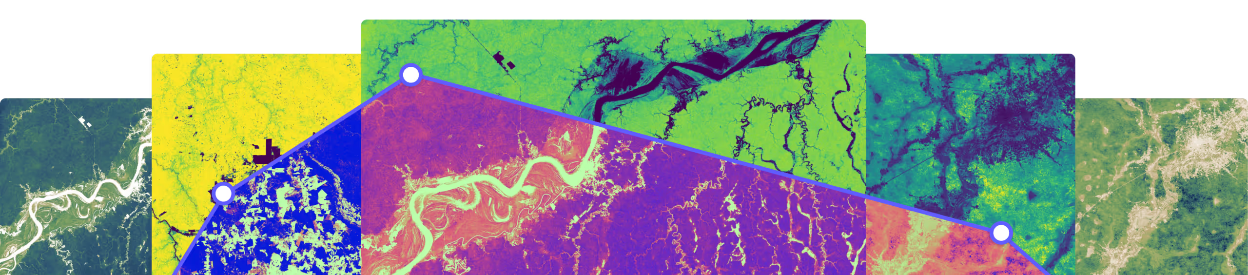
Access geospatially derived project design and MRV data and mapping radically faster and cheaper, powered by Sylvera's uniquely calibrated Atlas forest timeseries, saving time and money without compromising accuracy.
Vetted data service provider for VM0047 inception and dMRV
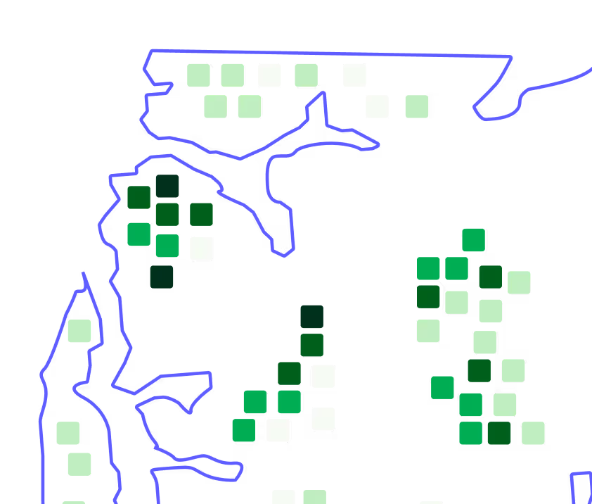
Site eligibility, donor pool mapping, stocking Index, stratification, biomass baseline and control plot matching at inception and for reporting. See the Verra announcement
CAR, ACR IFM v2.1 and other
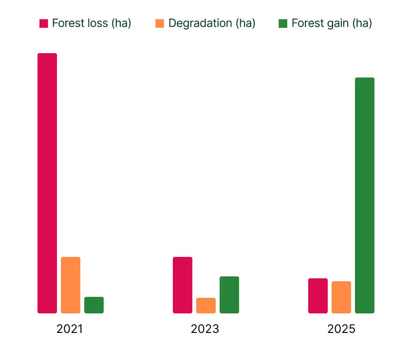
Baseline harvest intensity, common practice modelling, project specific calibration, disturbance modelling ex-post updates that match methodology and registry requirements.
Custom and portfolio wide geospatial analytics
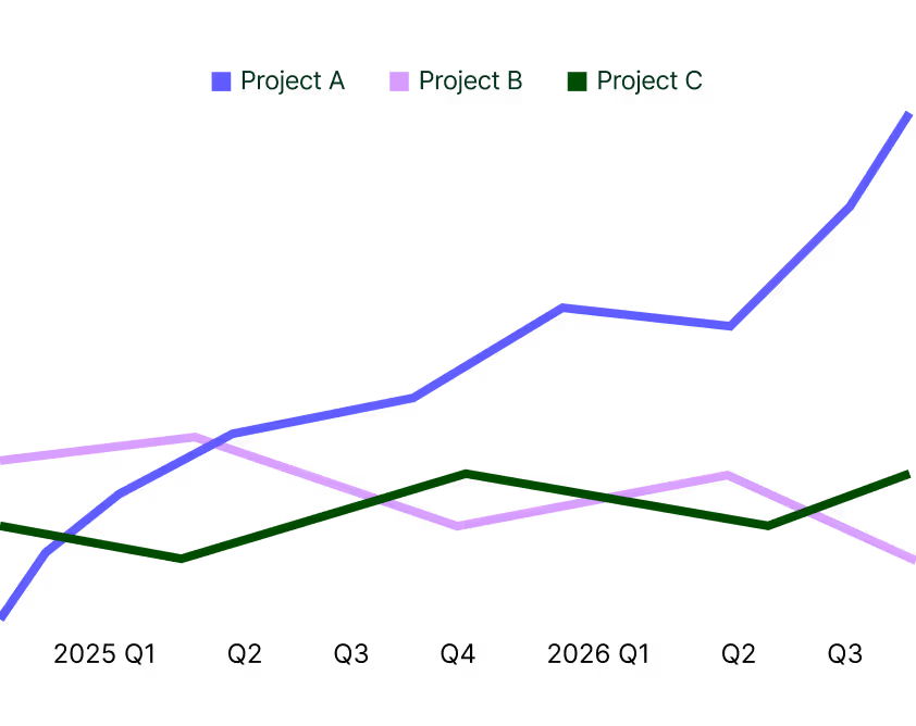
For any set of AOIs, your own metrics for Biomass, Forest stats, physical and climate risks served regularly for your project and portfolio management needs.
What sets Sylvera's Earth Analytics apart
Named as a vetted data service provider by Verra and built on proprietary Multi-Scale lidar data collected across 250,000+ hectares to provide market-leading accuracy at a cost effective price point
Typical project design data

FAQs
Our pricing is competitive and scales with your usage. Costs depend on the number of projects, shared data and analysis across portfolios, and any custom requirements. Contact the team to discuss your needs. Contact the team to discuss.
Although dependent on project specifics and any customisation, usually in days.
Today, comprehensive analyses are delivered by Sylvera analysts using our internal tools, with a white-glove service that includes direct collaboration and insight through discussion. We’re progressively rolling out self-serve access through our Pioneer Programme. If you’re interested in early access, contact us to discuss.
Sylvera is an independent actor in the carbon market and recognized by Verra as the vetted data service provider for VM0047.
We are not incentivized by the volume of credits generated. Instead, we’ve invested over four years and more than $10M to address a fundamental constraint on scaling EO approaches: the lack of field and lidar data. This independence allows us to focus on getting the answers right for our users and the market.
Sylvera’s teams both actively align with methodology requirements and engage directly with technical teams at standard setters. Indeed, Sylvera has been selected to provide Biomass Atlas data directly to two separate Standards Bodies. For first-of-a-kind use cases, we are happy to engage stakeholders alongside our users to ensure strict compliance.
Sylvera deeply understands the importance of trust when it comes to client data business. Uniquely in this space, Sylvera is ISO 27001 compliant, ISO 27001 is the leading international standard for Information Security Management Systems (ISMS), providing a risk-based framework to protect data confidentiality, integrity, and availability. We have undertaken highly sensitive work for governments, institutional finance, top tier consulting firms and the largest companies in the world without a single data leakage incident to-date.
Reasonable AOI changes are typically handled at no additional cost. If a change materially affects scope or analysis, we’ll discuss it with you upfront.
Yes. You’re free to switch to another provider at any time. Because projects are treated consistently and systematically, porting your MRV is typically far easier than with bespoke consultant-led work, which can be difficult to replicate.
Discuss your project
Explore the forest data powering real-world investment and procurement decisions.